
While I've taken somewhat of a hiatus from fly fishing as of late (notwithstanding an Alaska trip coming in August), I have kept busy with exploring all that Northern Nevada has to offer. I've actually taken it to the next level with some pretty amazing finds including 1) the location of where the oldest mummy in the world was found (9,400 BP), 2) the oldest petroglyphs in North America (14,800-10,500 BP), 3) lest us not forget some of the oldest petroglyphs in South America as well (~12,000 BP - potentially older than N. America), 4) the location of where evidence of one the oldest indications of mans first existence in North America was found (grass hopper cache at 14,195 BP) as well as 5) some of the earliest sites where now extinct megafauna (camel and horse [before Spaniards brought the horse back to the Americas]) were found alongside humans remains (10,900 BP and 11,999 BP).
Does this turn any part of the Clovis theory on its head? The idea that that the peopling of North America occurred via the Bering land bridge at the end of the last ice age 10,000-11,000 BP...you decide. I won't even mention the discoveries in South America (Pedra Furada) which potentially go back much, much earlier, and suggestive that at least South America was possibly inhabited first by ocean traveling peoples from southern Asia, or, northeastern Siberians that (in addition to using the Bering land bridge), also used boats to settle South America before much of North America had itself been settled. This is part of a 5 part picture post and will focus on item 5 above (minus Leonard Rock shelter [11,999 BP] which I've determined the location for but have yet to visit).

.

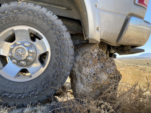
Poor Power Wagon, lucky I didn't rip off my shock.
I'm pretty stoked about this cave below, my youngest son found it, high up on a rocky crag. As far as I can tell, it doesn't have a name, it certainly hasn't been excavated, and based on its elevation, I feel it could have artifacts that exceed 11,000 BP. I say that because the higher the cave, generally speaking, the older the inhabitants. As ancient Lake Lahontan receded post highstand during the last ice age (14,500-13,000 BP), wave action created the caves, then as it receded further, the waterline fell below the cave, allowing humans to move in and claim new lakeshore shelter.

Below is the biggest cave in the system, unlike most caves that are little more that covered shelters to keep the wind and rain away, this cave is actually a large internal cavern, it opens up to a vaulted ceiling, and has a 2nd level approximately 25 feet above the entrance, along with a secrete chamber at the very back, approximately 150 feet from the entrance. This cave had the potential to hold a lot of people, and even had a sky light that I surmise was ideal for allowing smoke to exit the cave without asphyxiating its inhabitants.

This cave and the one adjacent to it (below) had the 14,195 BP grasshopper cache, some of the oldest evidence of man in all of North America. That means they were in this cave thousands of years prior to the end of the last ice age which I believe has archeologists scratching their heads. Note the clear tailings sloping to the left, a sign this has cave has been excavated.

This final cave below was an utter disappointment. It was professionally excavated in 52, 53 and 54, however, someone in the past year decided to take a pick and a shovel and dig a trench between 3 and 4 feet deep through the center of the floor. Such a shame, this wasn't here when I was here last, exactly 1 year ago, and you can tell this trench was not dug by professional archeologists.

Below is a shot of what I call the "sky light", its technically a 2nd entrance to one of the caves but is pretty tough (and not necessarily safe) to go down. the cave floor is about 18 feet down a very dark and steep grade.

Hope you enjoyed this post, I have a few more post from my excursions over the past year to unload soon, so stay tuned.


