Showing posts with label petroglyphs. Show all posts

Monday, May 3, 2021

The peopling of North America

While I've taken somewhat of a hiatus from fly fishing as of late (notwithstanding an Alaska trip coming in August), I have kept busy with exploring all that Northern Nevada has to offer.  I've actually taken it to the next level with some pretty amazing finds including 1) the location of where the oldest mummy in the world was found (9,400 BP), 2) the oldest petroglyphs in North America (14,800-10,500 BP), 3) lest us not forget some of the oldest petroglyphs in South America as well (~12,000 BP - potentially older than N. America), 4) the location of where evidence of one the oldest indications of mans first existence in North America was found (grass hopper cache at 14,195 BP) as well as 5) some of the earliest sites where now extinct megafauna (camel and horse [before Spaniards brought the horse back to the Americas]) were found alongside humans remains (10,900 BP and 11,999 BP).  

Does this turn any part of the Clovis theory on its head? The idea that that the peopling of North America occurred via the Bering land bridge at the end of the last ice age 10,000-11,000 BP...you decide.  I won't even mention the discoveries in South America (Pedra Furada)
 which potentially go back much, much earlier, and suggestive that at least South America was possibly inhabited first by ocean traveling peoples from southern Asia, or, northeastern Siberians that (in addition to using the Bering land bridge), also used boats to settle South America before much of North America had itself been settled.  This is part of a 5 part picture post and will focus on item 5 above (minus Leonard Rock shelter [11,999 BP] which I've determined the location for but have yet to visit).

These places are not hard to find right?  Just read up on old archeological reports from the early 40's and 50's, spend 2 weeks on Google Earth until you think you have the spot, drive to a place like this, don't care about what will happen to your truck, and then start scouring the hillsides at a very specific elevation, Google Earth is your friend, and the highstand of ancient Lake Lahontan is your bellwether.  You'll need to trisect your locations, look for all available clues, and if you find a site, respect it, observe,  ponder, and take a picture, its that simple.  
.
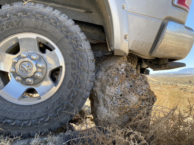
Poor Power Wagon, lucky I didn't rip off my shock.

I'm pretty stoked about this cave below, my youngest son found it, high up on a rocky crag.  As far as I can tell, it doesn't have a name, it certainly hasn't been excavated, and based on its elevation, I feel it could have artifacts that exceed 11,000 BP.  I say that because the higher the cave, generally speaking, the older the inhabitants.  As ancient Lake Lahontan receded post highstand during the last ice age (14,500-13,000 BP), wave action created the caves, then as it receded further, the waterline fell below the cave, allowing humans to move in and claim new lakeshore shelter.


Below is the biggest cave in the system, unlike most caves that are little more that covered shelters to keep the wind and rain away, this cave is actually a large internal cavern, it opens up to a vaulted ceiling, and has a 2nd level approximately 25 feet above the entrance, along with a secrete chamber at the very back, approximately 150 feet from the entrance.  This cave had the potential to hold a lot of people, and even had a sky light that I surmise was  ideal for allowing smoke to exit the cave without asphyxiating its inhabitants.


This cave and the one adjacent to it (below) had the 14,195 BP grasshopper cache, some of the oldest evidence of man in all of North America.  That means they were in this cave thousands of years prior to the end of the last ice age which I believe has archeologists scratching their heads.  Note the clear tailings sloping to the left, a sign this has cave has been excavated.

This final cave below was an utter disappointment.  It was professionally excavated in 52, 53 and 54, however, someone in the past year decided to take a pick and a shovel and dig a trench between 3 and 4 feet deep through the center of the floor.  Such a shame, this wasn't here when I was here last, exactly 1 year ago, and you can tell this trench was not dug by professional archeologists.
Below is a shot of what I call the "sky light", its technically a 2nd entrance to one of the caves but is pretty tough (and not necessarily safe) to go down.  the cave floor is about 18 feet down a very dark and steep grade.


Hope you enjoyed this post, I have a few more post from my excursions over the past year to unload soon, so stay tuned.

Wednesday, March 12, 2014

Off Roading in Nevada - The Tungsten Workings of the Nightingale Mining District, Nevada

This off road adventure up Coyote Canyon allowed us to step back in time and visit our native and mining pasts.  It started out as just a way to get out with the boys and see some country you can only access with a worthy off road rig and a good map.  The trip far exceeded our expectations and won't soon be forgot.  Forgive the picture-rich post which has nothing to do with fly fishing, but this winter's fly fishing has been a drought (pun intended) and I couldn't help myself.

The trek began early one Sunday morning in Reno, then east towards Wadsworth, north through the Pyramid Paiute Reservation and the budding metropolis of Nixon, then northeast through old mining roads and canyon washes until you reach the eastern slopes of the Nightingale Range near the intersection of Washoe, Pershing and Churchill Counties.  

As you leave Nixon bearing north east, you'll parallel a ravine which appears to have held a substantial water supply at one point.  This ravine (pictured below) would be the pre-Derby Dam terminal arm of the Truckee River which supplied Winnemucca Lake with its life blood....water.  Before Derby Dam diverted water from Pyramid Lake, it was approximately 100 feet higher and overflowed its banks creating another 6.5 mile section of the Truckee River which fed Lake Winnemucca.  Derby Dam was built in 1903, the aforementioned arm of the Truckee stopped flowing soon thereafter and the lake was dry by 1939.  Its hard to believe that only 120 years ago, Paiutes used to stand on the river banks and harpoon fish as they migrated between the two lakes.  Additionally, the Paiutes hunted migratory water fowl that used the former lake for food and refuge.  Following the lake's demise, the migratory path of the waterfowl shifted to the north.  

 Would you ever know gazing upon this expansive desert playa (below) that less than 90 years ago it was a 100-foot deep terminal lake teaming with wildlife and supporting Indians along its shoreline?
 There are extensive Tufa rock formations which border both Pyramid Lake and Lake Winnemucca's shorelines.  Tufa is a porous variety of limestone that generally forms along lake shores.  You'll find Tufa throughout the Great Basin in the footprint of Ancient Lake Lahontan.  Paiutes inhabited many of the caves which abut its peripheries.  Below we found a set of caves which appeared likely to have been used as shelters thousands of years ago.
Below, soot from fires appears to have coated the Tufa pillows in this particular cave which adjoined the shoreline of former Lake Winnemucca less than a century ago.
Perched high on the mountain, an smaller cave sits above the first which also appeared to bear the signs of ancient fires.  Though we were on its eastern shores, the petroglyphs on the western reaches of Lake Winnemucca date back from between nearly 11,000 and nearly 15,000 years ago and are widely considered the oldest petroglyphs in North America.

Coyote Canyon trail often takes the form a seasonal wash.
Below are the lower workings of the Jaybird Tungsten Mine.  This adit was through pretty solid granite which was not fragile like shale or limestone workings.  A floor void of debris and an adit w/o the need for cribbings for support gave me confidence to take a quick peek inside.  Watch for the black damp, generally not a concern near a portal (I don't have a death wish and I didn't go that deep).
A stope braced with large juniper logs...where did those come from, the Nightingale Range is devoid of timber.
Good to see some guzzlers full of water in a dry year like this.


An old mining cabin at the Nightingale Mine, partially buried...I suppose for insulation?

The Nightingale Mine was the biggest tungsten producer in the district.  Its massive workings and tunnels follow a vein of limestone and shale which abut a layer of granite.
Below is a winch frame atop a deep shaft.

I believe this mill was built by the Gold-Silver-Tungsten Co, Inc. and was designed to handle 100 tons of ore/day but saw very little use.  Mining companies often times got ahead of themselves and built infrastructure that wouldn't always be supported by the minerals in the area.
A flat bed of sorts, looked like it was part of a wagon but who knows.
Here you can appreciate the size the the limestone vein which was mined as far as 128 feet down.  These open stopes continue for approximately 1,600 feet (north to south).
Portals like this dot the hills.

A road less traveled.
Either the beginnings of a shaft near High Grade Mine or one which outlived its usefulness and collapsed
High Grade Mine Cabin
Needs a little TLC
Smoke shack?  Storage/cellar?  Can't figure it out, it had a stove flue in it, but was too small to house people...anyone know what it is?
Finally something they can check out.
Below is the upper MGL Mine Canyon, I don't know its real name but it hides a "secret" mine on the upper western slope (the road to the right).
I wouldn't have stumbled across this mine were it not for Google Earth.  You wouldn't expect a mine to be here...you wouldn't expect anything to be here.
TNT was stored here years ago.
Away from anything which could set it off.
Not sure what this cabin was use for, it was on the same grade as the ore bin seen toppled to the right.
Another shot of the ore bin.
16" pipe?  Where did they get the water to necessitate such a massive diameter pipe?  What did they do with the water?  Was this used to power a monitor to strip the hillside?  There are a couple meager springs nearby....that's it.
Okay, this is the type of mine that doesn't give you a good vibe.  Fractured limestone, unstable everything and collapsed cribbings to the right. 
A quick picture of this crazy timber framing that goes up 3 levels and down as far as light will let you see.  Time to get the "@#$%" out and view from a safe distance above.
Even outside of the mine you need to be mindful of where you step.  most dangers lurk above the main portals where stopes and air shafts inconspicuously protrude through the surface.  
Here you can appreciate the magnitude of the workings and just how hopelessly screwed you'd be should you fall into them.  You also have to ponder the skill, labor and dedication required to mine this back in the 1920's and 1930's.
This ladder is probably 15 or 16 feet long, compare that close up to the picture above.
60 or 70 feet of sheer vert.
An unmarked hole atop the upper workings....the ground you see below is a good 70 feet down.
6 foot human as scale (well, 5'10, but don't tell him that).
If you look close, you can see a winze and what appears to be a head frame for the main vertical lift.
Stay back, stay far back!
Ah, my keys, so close yet so far away.  Got to love the auto-lock technology on these new vehicles.
Hurts a bit...new truck.
The deed is done.
The Arch....We Found It!!!  Was a complete accident on a wild goose chase for a mine that wasn't even a mine.
Goofy picts never get old.
One last Indian Cave on the way out, the backdrop is amazing.